 |
|
| Serving Copiah, Hinds, Madison, Rankin, Simpson, Warren, and Yazoo Counties... |
|
|
 |
|
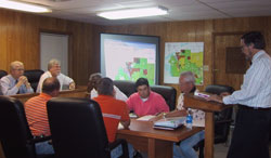
Comprehensive Planning
 Mississippi counties and municipalities that wish to have a zoning ordinance and official zoning map are required by state law to prepare a comprehensive plan upon which they can base
their zoning. If the plan is for a municipality, it must encompass a study area within its paths of growth over the next 20-25 years.
Mississippi counties and municipalities that wish to have a zoning ordinance and official zoning map are required by state law to prepare a comprehensive plan upon which they can base
their zoning. If the plan is for a municipality, it must encompass a study area within its paths of growth over the next 20-25 years.
CMPDD is the only planning and development district in Mississippi which has a staff of professional planners. As a result, the District is continuing to provide comprehensive
planning assistance to local communities both within and outside Central Mississippi.
A comprehensive plan is composed of four elements:
Goals and Objectives: This element addresses long-range goals and objectives regarding residential, commercial, and industrial development; parks, open space and recreation; street
improvements; public schools and community facilities.
Land Use Plan: The District uses its Geographic Information System (GIS) to prepare a base map of the study area. Next, all existing land uses in the study area are inventoried, and
a color-coded existing land use map is prepared. Based on 2000 Census data, CMPDD develops future population projections in five-year increments. Next, the District prepares a
large-scale, full-color Land Use Plan map depicting proposed land uses for residences, commerce, industry, recreation and open space, and public/quasi-public facilities and lands.
The Land Use Plan is based upon projections of population and economic growth and upon the proposed Goals and Objectives element. The Land Use Plan includes a Housing Element
involving an analysis of housing needs based in part on a structural conditions inventory conducted by the District. CMPDD projects housing needs in terms of population growth
and recommends areas that are most suitable for various forms of housing.
Transportation Plan: CMPDD also prepares a Transportation Plan depicting in map form the proposed functional classifications (principal and minor arterial, collector and local)
for existing and proposed streets, roads , and highways. Street and highway improvements are proposed and potential funding sources identified for implementing the improvements are
identified. Other transportation needs, such as airport needs, are also addressed as appropriate.
Community Facilities Plan: This last element includes an inventory of existing facilities and projections of future needs regarding: public buildings, public education, parks and
recreation, and utilities (water and sewer) and drainage.
For more information on comprehensive planning, please contact either Bruce Reynolds or Larry Smith.
Revised: March, 2006
|
DEPARTMENTS
-
-
-
-
-
-
-
-
- |
-
-
|
|
|
|
|
|
|
|
|